Blogs
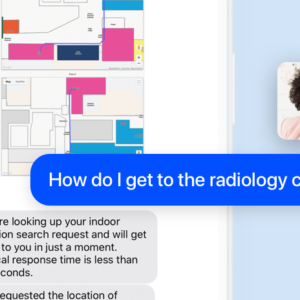
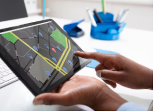
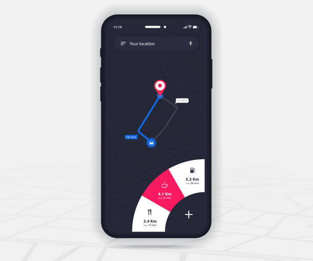
The Cartogram SMS Chatbot
This blog post is going to discuss Cartogram’s patent-pending SMS Chatbot service. This is just one way to access Cartogram’s wayfinding and indoor/outdoor navigation services. We’ll discuss what the chatbot does, what it doesn’t do, and several defining features of it including its semantic agnosticism, why it doesn’t require an app, how it will give…

MyChart Wayfinding
In the fast-paced world of healthcare, ensuring patients can easily navigate their way from home to appointments is paramount. The integration of Epic MyChart with Cartogram Wayfinding offers a powerful solution for seamless indoor and outdoor navigation. By harnessing the capabilities of Google Maps, Cartogram provides patients with start-to-finish wayfinding, streamlining the patient experience and…

What are Indoor Routing Algorithms?
Getting lost in the complex hallways of hospitals can be frustrating and time-consuming for patients, visitors, and even hospital staff. Indoor Routing Algorithms are computational techniques made to combat this issue. Let’s take a closer look at how such algorithms transform indoor wayfinding into a seamless and stress-free experience for everyone involved. Understanding Indoor Routing…

What are BLE Beacons?
Understanding Bluetooth Low Energy (BLE) Beacons Bluetooth Low Energy (BLE) beacons are small, battery-operated devices that utilize low-energy Bluetooth technology to transmit signals to nearby devices, such as your smartphone or tablet. These signals contain unique identifiers that BLE-enabled devices can detect within their proximity. BLE beacons are an excellent choice for indoor navigation due to…

What is Bluetooth Low Energy (BLE)?
Understanding Bluetooth Low Energy (BLE) Bluetooth Low Energy has revolutionized the wayfinding landscape, enabling seamless indoor navigation experiences that were once challenging. BLE operates in the Industrial, Scientific, & Medical (ISM) bands from 2.402 GHz to 2.48 GHz and builds Personal Area Networks (PANs). Although similar to classic Bluetooth, BLE has lower data transfer rates and…
Cartogram’s Guide to Indoor Wayfinding and Navigation
Guide Overview Many hospitals today lack effective indoor wayfinding systems, which leads to frustration, anxiety, missed appointments, delayed treatments, wasted resources, and even medical errors. There are many hurdles for hospital wayfinding, including: Complex Layouts Large Spaces Constant Changes Regulations that Limit Signage These issues have many effects, including: Eighty-five percent of visitors are asking for directions. Twenty-five…
Types of Hospital Wayfinding Solutions
Navigating complex indoor spaces like hospitals requires advanced wayfinding software solutions that cater to different user preferences and accessibility needs. An important aspect of this is accessibility, which Cartogram strives to provide through our various hospital wayfinding solutions. Web-Based Maps Cartogram’s web-based maps provide compatibility with IE, Firefox, Chrome, and Safari, ensuring that users can access them…
Navigating Healthcare: How Cartogram Reduces Patient Stress and Confusion
When we talk about healthcare, we rarely discuss how confusing hospitals can be. But most of us have experienced those moments when we’re running late, can’t find the right hallway, and feel stress mounting rapidly. That’s why we created Cartogram. We wanted to provide people with an easier way to navigate complex medical campuses, and…
Why Every Modern Hospital Needs an Indoor Positioning System?
Hospitals today are more complex than ever. Most of us know what it feels like to walk into a massive medical campus and instantly lose our sense of direction. Long hallways, confusing floor layouts, and unclear signage turn simple visits into stressful experiences. That is exactly why hospitals across the country are shifting toward smarter…

How Wayfinding Software Enhances Visitor Experience in Hospitals
Walking into a large hospital can feel overwhelming. Multiple entrances, unclear signage, endless parking lots — and the clock ticking toward your appointment. It’s easy to feel lost before care even begins. That’s precisely where Wayfinding Software comes in. In this web blog, we’ll break down how Wayfinding Software transforms hospital navigation for patients, visitors, and…

How to Implement Indoor Navigation Maps?
Navigating a large hospital or health complex can be a daunting experience. Long halls, several buildings, and confusing floor layouts have a way of leaving patients, visitors, and even employees lost. Getting lost isn’t merely stressful; it can lead to late or missed appointments, delayed procedures, and unnecessary disruptions for hospital staff. This is where…
The App That Helps You Navigate Inside Hospitals
Let’s be honest, no one walks into a hospital completely relaxed. Whether you’re the patient, the one driving the patient, or the loved one tagging along for moral support, the experience starts with a subtle sense of pressure. You’re watching the clock, trying to remember the building name, and wondering if “North Tower C” is…

How Do You Find Your Way Around a Hospital?
When a person enters a hospital for the first time, they enter a maze. The uncertainty of where to go can be overwhelming, whether you’re a patient hurrying to an appointment, a nervous family member searching for a loved one, or a new employee adjusting to a large campus. Hospitals are meant to be healing…
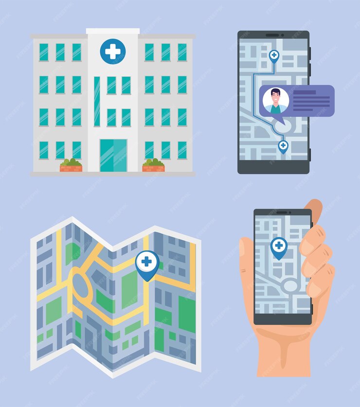
Does Google Maps Have Indoor Navigation?
Google Maps is a navigation platform that assists millions of users with their city and neighborhood route-finding needs. Now, consider the challenge of navigating a large healthcare facility. This is where indoor navigation becomes essential.While some believe Google Maps offers complete indoor mapping features like its outdoor navigation, its capabilities for precise indoor route directions…
What Are the Top Benefits of Indoor Navigation for Seamless Wayfinding?
Stepping into a hospital can be a maze, especially for first-time visitors. While GPS works well outdoors, it struggles to provide accurate indoor navigation. So, how can you bring the Google Maps experience indoors? The answer is Indoor Navigation technology, which offers precise, real-time turn-by-turn directions indoors. In medical facilities, where time and efficiency matter…

Enhance Visitor Experience with Advanced Indoor Navigation
Huge, unfamiliar hospital campuses often frighten patients, visitors, and even staff while making their way around. Long and winding hallways, diverse departments, and complicated settings make it difficult to determine the right destination at challenging times. This is exactly where indoor navigation steps up as a revolutionary solution that turns the way people navigate within…

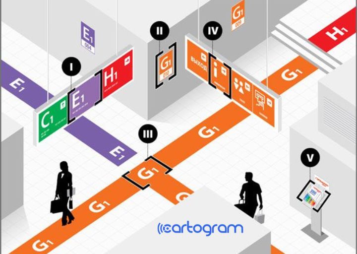
Permission-Based Routing
In this article we’re going to discuss permission-based routing with Cartogram. What is permission-based routing? It’s Cartogram’s ability to give different people in your building different content, routes, and landmarks based on their permission level. The janitors can have routes for taking large bins around the building, the patients can avoid the maintenance- and staff-only…
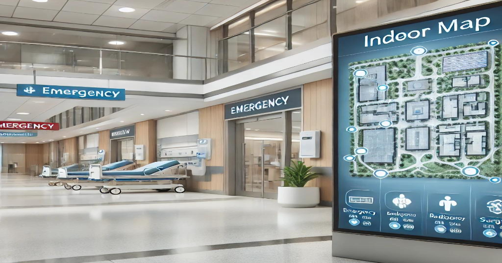
Why Hospitals Need Indoor Maps
Why Indoor Wayfinding in Hospitals is a Critical Issue Have you ever been lost in a hospital? If so, you are not alone. Hospitals are complex environments that can be confusing and stressful for patients, visitors, and staff. Indoor wayfinding is the ability to navigate inside a building using signs, maps, directions, and other cues. It is…
The Invisible Cost When Your Patients Get Lost
How do patient no-shows affect the healthcare industry? When looking at the shortcomings of the healthcare industry and areas in which it could improve, there is no doubt that patient no-shows need to be a higher priority. With patients who miss their appointments, the American health system suffers a loss of approximately $150 billion annually,…
Nearly One -Third of First -Time Visitors to Hospitals Get Lost
The Problem Birmingham, Alabama. One-quarter of the city’s central business district comprises The University of Alabama, Birmingham’s Medical Center. That is 4 million square feet of hospital space. How can you find the office you seek at a complex like this? It’s like finding a needle in a haystack. UAB Medicine is not unique in…
What are Inertial Navigation Systems (INS)?
Understanding Inertial Navigation Systems (INS) GPS signals become scarce when you enter a building, making traditional navigation tricky. That’s where INS comes in. INS is a smart technology that uses motion and rotation sensors to calculate your position, velocity, and orientation, all without relying on GPS. It’s like having your own personal navigator inside your…
What are Integration Partners?
Cartogram offers an indoor wayfinding solution that seamlessly integrates with various hospital systems, ensuring a smooth and stress-free user experience. With multi-platform compatibility and comprehensive integration support, Cartogram empowers your hospital to optimize patient indoor navigation with a seamless transition. Understanding What Integration Partners Are Integration partners are companies collaborating with their different platforms to create a…

The Patient Experience Doesn’t Start at the Door
Every hospital in the country must participate in the Hospital Consumer Assessment of Healthcare Providers and Systems (HCAHPS) survey of patient satisfaction, which can directly affect funding. The patient experience is crucial in medical centers’ ability to provide healthcare. Many would think the patient experience starts when someone is brought in the front door by…

What are Searchable Points of Interest (POIs)?
Understanding Searchable Points of Interest (POIs) Searchable Points of Interest (POIs) are specific locations within a venue you might want to visit or explore. These include shops, restaurants, restrooms, elevators, ATMs, and other facilities. POIs are the destinations you seek while navigating indoor spaces; efficient access to information about these locations is crucial to simplify…
What are Indoor Positioning Systems (IPS)?
Understanding Indoor Positioning Systems (IPS) An IPS is a technology designed to locate and track objects or people within indoor environments where Global Positioning System (GPS) signals are either weak or unavailable. While GPS works effectively outdoors, its signals struggle to penetrate walls and reach the interior of buildings, making it unsuitable for indoor navigation….
Next-Gen Enterprise Indoor And Outdoor Wayfinding With Cartogram
Moving through the big hospitals can be challenging, as one does not know where to turn to reach their destination. The list of challenges is endless, but what if there was a way to make this journey seamless and stress-free? It would be like a hospital navigation app that leads you right to the destination,…
What is a Map Content Management System?
Navigating complex indoor spaces like hospitals requires up-to-date maps to ensure a smooth and stress-free patient, visitor, and staff experience. A map Content Management System is a tool designed to create and maintain accurate indoor maps for web and app-based platforms. This article will explore how Cartogram ensures maps stay up-to-date in a hospital’s rapidly…
What are Personal Area Networks (PANs)?
Understanding Personal Area Networks (PANs) Personal Area Networks (PANs) are a subset of wireless networks created by Bluetooth Low Energy (BLE) to cater to individual users or devices within a specific area. These networks create a localized communication environment, enabling devices to connect and interact efficiently. The PAN concept revolves around personalization, allowing customized communication…

Wayfinding Software as a Weapon for Hospitals
The COVID-19 pandemic is a wakeup call for the importance of patient routing, and logistics. How did we get here? How do we slow it down? How can we be best prepared for the next virus? While there is no silver bullet, the best advice is to deploy multiple upstream strategic initiatives. Consider the following,…

Summer 2018 High School SPARKSIP Interns
This summer we have been pleased to welcome five high school interns from Redmond, Wash. School district. The SPARKSIP intern program Cartogram welcomed five interns for the summer program. Four of them will be seniors this coming year, and one is going on to college. The four students attend the Tesla STEM high school, and our returning intern Rohin recently graduated from Redmond High…