Cartogram’s Guide to Indoor Wayfinding and Navigation
Guide Overview
Many hospitals today lack effective indoor wayfinding systems, which leads to frustration, anxiety, missed appointments, delayed treatments, wasted resources, and even medical errors.
There are many hurdles for hospital wayfinding, including:
These issues have many effects, including:
- Eighty-five percent of visitors are asking for directions.
- Twenty-five percent of hospital staff are unfamiliar with parts of their hospital.
- Staff spend 40 hours a year giving directions.
- A cumulative loss of $150 billion in the US Healthcare system.
- A decrease in patient satisfaction scores.
- Indoor wayfinding systems have features to combat these losses, including:
- Indoor Mapping
- Bluetooth Low Energy (BLE)
- Accurate Indoor Positioning
- Inertial Navigation System (INS)
- Indoor Routing Algorithms
- Searchable Points of Interest
- Diverse Wayfinding Platforms
- Content Management Systems
Cartogram provides a line of features for a comprehensive hospital wayfinding solution:
- Interactive Web-Based Maps
- Google Maps Visualization
- Printable PDFs
- Searchable Points of Interest
- User and System Analytics
- QR Codes
- Custom Branding
- Dynamic & Customizable Turn-by-Turn Directions
- Mobile and Web-Based Maps
- Content Management System
- Hospital-Customized iOS and Android Application Publishing
- Native iOS and Android SDK Integration
- Integrations
- Direct Access to Cartogram APIs
- BLE Infrastructure Management
- SMS Chatbot and 24/7 Wayfinding Call Center
Why Indoor Wayfinding in Hospitals is a Critical Issue
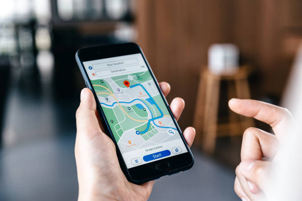
Have you ever been lost in a hospital? If so, you are not alone. Hospitals are complex environments that can be confusing and stressful for patients, visitors, and staff. Indoor wayfinding is the ability to navigate inside a building using signs, maps, directions, and other cues. It is essential for providing a positive user experience and improving the quality of care in hospitals.
Today, many hospitals lack effective indoor wayfinding systems, which can lead to frustration, anxiety, missed appointments, delayed treatments, wasted resources, and even medical errors. In this blog post, we will explore why indoor wayfinding in hospitals is a critical issue and how modern technology can improve it.
The Challenges of Wayfinding in Hospitals
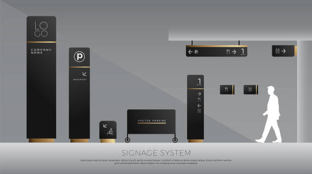
- Complex Layouts
Hospitals have varying layouts throughout the building, with each floor serving a unique purpose. From specialized wards to diagnostic centers and administrative offices, each section demands a different wayfinding approach. Navigating through these distinct layouts can be challenging, particularly for individuals unfamiliar with the hospital’s organization. This complexity can lead to unnecessary wandering and anxiety, hindering the overall patient experience and potentially impacting medical outcomes.
- Large Spaces
Modern hospitals often have multiple floors with various departments, clinics, and treatment areas, creating a significant challenge for patients and visitors regarding indoor wayfinding. Finding the right floor or department can be overwhelming, leading to confusion and delays in reaching essential medical services. Moreover, traditional GPS systems, designed for outdoor use, struggle to function accurately within these multi-story spaces, exacerbating these navigational struggles. - Constant Changes
Hospitals are constantly adapting. As medical technology advances and patient demands change, hospitals frequently undergo renovations, expansions, and reconfigurations. While these changes are vital for providing high-quality medical care, they create a significant hurdle for wayfinding. New construction, closed-off areas, and shifting departments can leave patients and visitors feeling disoriented and lost, hampering their ability to navigate the hospital efficiently. - Regulations Limit Signage
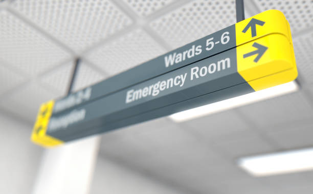
While clear signage is crucial for wayfinding, the healthcare environment must comply with stringent regulations. These safety guidelines often restrict physical signage in certain hospital areas, especially near sensitive medical equipment or infection-prone zones. As a result, traditional wayfinding methods may fall short of providing comprehensive guidance to patients and visitors. Striking the right balance between effective wayfinding and adherence to safety protocols poses a constant challenge for hospital administrators and wayfinding designers.
The Effects of Indoor Wayfinding Challenges
- Eighty-five percent of Patients and Visitors Ask for Directions in a Hospital.
Navigating through the intricate corridors and numerous floors of a hospital can be an overwhelming experience for patients and visitors. A staggering 85% of individuals seek assistance and directions, leading to delays in reaching appointments and essential medical services. This adds to their stress and strains the hospital’s resources as staff must dedicate time to guiding lost individuals. - Twenty-five percent of Hospital Staff Don’t Know Certain Hospital Locations.
Hospital staff, the backbone of patient care and support, can also face challenges regarding wayfinding. Approximately 25% of hospital employees report difficulty locating specific destinations within their healthcare campuses. This lack of familiarity with hospital layouts can lead to inefficiencies in service delivery and inaccurate directions to hospital visitors, causing further delays. - Hospital Staff Spend, on Average, 40 Hours Every Year Helping with Directions.
Hospital staff is heavily burdened with providing wayfinding assistance to patients and visitors. Hospital employees dedicate around 40 hours annually to guiding lost individuals. This considerable time investment affects staff productivity and takes away valuable moments that could have been utilized for patient care and other critical tasks. - The US Healthcare System Loses $150 Billion Annually to Wayfinding Challenges.
A lack of efficient indoor wayfinding systems contributes to missed appointments and rescheduling, resulting in significant hospital financial losses. Hospitals lose around $3 million annually due to missed appointments. These losses affect the hospital’s revenue and strain healthcare resources. The cumulative monetary loss due to missed appointments in the US healthcare system amounts to a staggering $150 billion annually. - Decline in Patient Satisfaction Scores (HCAHPS)
The wayfinding experience significantly influences patients’ overall satisfaction with their hospital visit. A lack of clear and accessible wayfinding can lead to frustration and anxiety, resulting in lower Hospital Consumer Assessment of Healthcare Providers and Systems (HCAHPS) scores. Decreased HCAHPS scores can tarnish a hospital’s reputation and affect patient retention and loyalty.
Indoor Wayfinding Solutions
Navigating hospitals’ intricate and dynamic environments can be challenging for patients, visitors, and hospital staff. Fortunately, advanced technology offers a promising solution – Indoor Positioning Systems (IPS). These systems use sensors, beacons, Bluetooth, or other methods to locate and track users precisely within the hospital premises. IPS enhances wayfinding and empowers hospitals to optimize the flow of people, assets, and resources, ultimately improving the overall healthcare experience.
IPS Includes:
- Indoor MappingIPS employs digital 2D or 3D indoor maps that visualize a hospital’s floor plan and spatial data. These interactive web-based maps offer users a user-friendly experience and integrate seamlessly with Google Maps visualization, allowing for familiarity and ease of use. Hospitals can customize and update indoor maps, labels, and other information, ensuring that hospital layouts and information remain current.
- Bluetooth Low Energy (BLE)
Bluetooth Low Energy transforms the wayfinding landscape by connecting easily to smart devices.
BLE operates in the Industrial, scientific, and medical (ISM) bands from 2.402 GHz to 2.48 GHz and builds Personal Area Networks (PANs). PANs are a subset of wireless networks that cater to individual users or devices within a specific area. Although similar to classic Bluetooth, BLE has lower data transfer rates and reduced power usage, enabling BLE devices to establish proximity connections and conserve energy for longer-lasting battery life.
At Cartogram, we utilize Bluetooth Low Energy within our software using BLE beacons. BLE beacons are small, battery-operated devices that utilize low-energy Bluetooth technology to transmit signals to nearby devices. When your smartphone or device comes within the range of a BLE beacon, it receives its signal and accurately identifies your location. BLE IPS calculates location based on Received Signal Strength Indicators (RSSI). The BLE software stacks return the (RSSI) value, approximating distance with an accuracy of 2-4 meters. This technology facilitates seamless navigation through different floors and sections of the hospital, reducing confusion and optimizing the wayfinding experience.- BLE in Cartogram
Cartogram further ensures precise indoor navigation by installing multiple BLE beacons throughout a hospital and precisely mapping their locations. Cartogram’s wayfinding software triangulates your position in real-time, providing accurate indoor navigation assistance. This technology is precious in areas with unreliable GPS signals, such as indoor spaces with limited or no satellite reception.
The application continuously updates the route based on the changing proximity to BLE beacons as you move through the hospital, ensuring precise and real-time navigation. Turn-by-turn directions, interactive maps, and voice prompts guide you quickly, making the indoor navigation experience intuitive and seamless.
BLE is essential for indoor navigation because it can accurately represent your location by pairing with mobile applications and other devices.
- BLE in Cartogram
- Accurate Indoor Positioning
IPS determines the real-time location of mobile devices within the hospital’s interior. Thanks to a “Blue Dot” real-time turn-by-turn navigation feature, users can confidently navigate different floors and sections through dynamic, customizable, turn-by-turn directions. BLE infrastructure management ensures optimal performance and accuracy of location-based services.
An IPS is a technology designed to locate and track objects or people within indoor environments where Global Positioning System (GPS) signals are either weak or unavailable. While GPS works effectively outdoors, its signals struggle to penetrate walls and reach the interior of buildings, making it unsuitable for indoor navigation. IPS fills this gap using various techniques, such as Bluetooth Low Energy.
IPS technology is essential for accurate indoor wayfinding because it provides precision to your location. - Inertial Navigation System (INS)GPS signals become scarce when you enter a building, making traditional navigation tricky. That’s where INS comes in. INS is a smart technology that uses motion and rotation sensors to calculate your position, velocity, and orientation, all without relying on GPS. It’s like having your own personal navigator inside your smartphone.
- Your Guide: Inertial Measurement Units (IMUs)
Cartogram’s INS is powered by IMUs placed in your device. These special sensors keep track of your movements, accelerations, and turns as you walk through indoor spaces. - Accuracy Amplified: Sensor Fusion
To ensure spot-on accuracy, Cartogram’s wayfinding software uses sensor fusion algorithms. These algorithms blend data from IMUs with info from other systems, like BLE beacons and Wi-Fi, giving you reliable positioning even in busy indoor environments. - Trustworthy Predictions: Dead Reckoning
No worries if there’s a weak signal in certain areas! Cartogram’s INS has got you covered with dead reckoning. It cleverly estimates your position based on previous data and predicts where you’re headed. As soon as the signal is strong again, your location gets updated, and you’re back on track. - Non-Stop Guidance: Seamless Experience
With Cartogram’s INS, you get continuous navigation assistance, even if there’s a brief loss of connection to BLE beacons. You can rely on real-time directions to reach your destination efficiently and hassle-free.
- Your Guide: Inertial Measurement Units (IMUs)
- Indoor Routing AlgorithmIndoor Routing Algorithms are sophisticated computational techniques designed to streamline navigation within complex indoor environments. Combining advanced algorithms and innovative positioning technologies, they help users find their way throughlarge structures, such as hospitals, with precision and efficiency. These algorithms consider many factors, including accessibility, security, and map data.How does it work?
- Precise Positioning with Beacons
Indoor Routing Algorithms utilize strategically placed BLE beacons throughout the hospital premises as reference points. These beacons emit signals that mobile devices detect. Indoor Routing Algorithms accurately determine the user’s real-time location by triangulating signals from multiple beacons, ensuring precise positioning. - Map Content Management
Hospitals can edit routes within the hospital based on closures or renovations to keep routing up to date. This enables our Indoor Routing Algorithms to determine the best available route for visitors to follow without worrying about outdated data. - Special Considerations
Our algorithms consider additional data, including accessibility needs, user security requirements, closures, and the overall layout of the building. This ensures that various visitors’ needs are met, allowing ease of access for all. - Optimal Route Generation
With the visitor’s necessary data and the hospital’s updated floor plan, Indoor Routing Algorithms calculate the most efficient routes between indoor positions, adjusting routes based on special needs or circumstances. - Real-Time Updates
As users move through the hospital, our algorithms dynamically update their positions based on the changing proximity to beacons. This real-time tracking, known as “Blue-Dot Navigation,” ensures users always have the most up-to-date navigation assistance, even if they deviate from their route or encounter unexpected obstacles.
- Precise Positioning with Beacons
- Searchable Points of InterestIPS provides searchable points of interest, enabling users to quickly find specific locations, departments, amenities, or services within the hospital. By offering detailed information about various points of interest, IPS ensures that users can efficiently access the necessary resources.Searchable Points of Interest (POIs) are specific locations within a venue you might want to visit or explore. These include shops, restaurants, restrooms, elevators, ATMs, and other facilities. POIs are the destinations you seek while navigating indoor spaces; efficient access to information about these points is crucial to simplify your journey.Cartogram’s Searchable Points of Interest (POIs) FeatureOur wayfinding software labels and categorizes POIs within hospitals for easy identification. By allowing you to search for these points, you can find the most relevant information about your desired destination, streamline your routes, and optimize your indoor navigation experience.
- Effortless Navigation
The ability to search for specific POIs within a venue streamlines your indoor journey. If you’re looking for the nearest medical wing, restroom, or closest exit, our wayfinding software’s Searchable POIs feature ensures a seamless navigation experience without unnecessary detours. We know your time is valuable and want to ensure you reach your desired destinations efficiently. - Categories and Customization
Cartogram categorizes and customizes POIs based on their types, such as medical services or hospital amenities. This ensures that you can quickly locate your desired destinations, We believe in tailoring our software to cater to unique needs within different indoor environments. - Accessibility
Our commitment to inclusivity is reflected in the accessibility of Searchable POIs. We understand that users have various accessibility needs, and we have incorporated accessible POIs such as elevators, ramps, and accessible restrooms in our software. We want to ensure that everyone can navigate indoor spaces quickly and confidently, fostering inclusivity for all our users.
- Effortless Navigation
- Diverse Wayfinding PlatformsNavigating complex indoor spaces like hospitals requires advanced wayfinding solutions that cater to different user preferences and accessibility needs. Accessibility is an essential aspect of this, which Cartogram strives to provide through our various platforms.
- Web-Based Maps
- Cartogram’s web-based maps are compatible with IE, Firefox, Chrome, and Safari and support all major browsers, iOS, and Android platforms with HTML 5 support. This ensures users can access maps from various web browsers on desktops and laptops.
- Web-based maps are available on mobile, tablet, and desktop devices.
- Users can access floors, searchable points of interest, parking and entrance suggestions, and turn-by-turn directions.
- Cartogram enables outdoor-to-indoor and between-building navigation supported by Google Maps, a feature substantially different from other wayfinding solutions.
- App-Based Maps
- Cartogram’s app-based maps offer all the features of web-based maps for Android and iOS users.
- App-based maps also support Blue-Dot navigation, allowing users to see where they are in a hospital.
- Cartogram’s apps have many integration options, including integrations with Epic MyChart or a preexisting hospital app.
- Kiosks
- Hospitals and other businesses can embed Cartogram in digital signage or kiosks using the JavaScript SDK, providing on-site wayfinding assistance for visitors and staff.
- The kiosk includes printable versions of maps as PDFs, allowing visitors to access physical copies of maps and increasing accessibility.
- Text and Call-Based Wayfinding
- Cartogram’s SMS chatbot enables users to receive quick directions through wayfinding applications. Users can send inquiries via text, and the chatbot responds with a short description and a Cartogram location link.
- The location link app highlights the user’s destination and generates a route from their current location.
- This enhances accessibility for users who prefer text—and call-based interactions, have visual impairments, or prefer direct communication.
- Cartogram’s SMS chatbot enables users to receive quick directions through wayfinding applications. Users can send inquiries via text, and the chatbot responds with a short description and a Cartogram location link.
- Web-Based Maps
- Content Management System
A map Content Management System is designed to create and maintain accurate indoor maps for web and app-based platforms.What is an Indoor Map Content Management System?- Centralized Data Management
A Content Management System (CMS) is a centralized platform for all indoor map data, including floor plans, labels, routes, and location data. - Easy Map Creation and Customization
A vital advantage of a CMS is its user-friendly interface, which enables staff to easily add, edit, or remove content on the maps through a web or app-based platform. - Real-Time Updates
The dynamic nature of healthcare environments demands frequent map updates. A CMS enables real-time updates, ensuring that changes are reflected immediately. - Enhanced User Experience
CMS allows staff to keep maps updated with little effort, contributing to an improved user experience by providing accurate and easy-to-understand indoor maps.
- Labels
These are text-based elements displayed on the map. Labels can lie flat against the map as overlays or “pop up” like billboards and can be customized with details. - Beacons
These are the database representations of the physical beacon hardware inside a venue. Hospital staff can add or edit beacons and define notifications and user targeting. - Icons
Icons are images that indicate various points of interest. Like labels, they can be configured as overlays or markers. - Events
Events are temporary text-based elements that occur within specific time windows. These convey details like appointments, special programs, or limited-time services. - Tours
The CMS allows hospital staff to create predefined routes or tours inside the building. These tours guide users through specific points of interest or particular paths. - Floors
Floors can be created and differentiated for multi-floor buildings using images, tiles, or vectors. Hospital administrators can manage and update floor information. - Floor Connections
Floor connections include elevators, escalators, ramps, or staircases that facilitate movement between different floors. - Waypoints
Waypoints are an invisible layer on the indoor map, connecting the physical world to the indoor map’s visualization. They determine the route shown to users and define areas where users can and cannot walk.
- Centralized Data Management
What is Included in the Content Management System?
- Adding and Removing Paths
Hospital staff can easily edit sections on maps. Staff can swipe over the region of the map to edit its accessibility. Updates will be reflected in visitor directions. - Modifying Information
Cartogram’s CMS allows staff to customize points of interest, using features like labels, events, and tours to provide users with accurate and specialized information. - Web and App-Based Platforms
Hospital staff can access the CMS to view and edit maps through a secure web portal or a mobile application.
While Cartogram’s CMS empowers hospital staff with user-friendly map management tools, Cartogram can collaborate with the hospital to ensure that maps are tailored to their needs. Cartogram experts can manage map content directly at the hospital’s request and provide ongoing support to hospital staff using the CMS.
Cartogram’s Features
Cartogram provides a comprehensive solution, targeting every potential issue of indoor wayfinding. Our services are designed to optimize navigation experiences within complex indoor spaces, such as hospitals, campuses, airports, and commercial facilities. With a commitment to delivering user-friendly and efficient solutions, Cartogram empowers businesses to improve customer satisfaction and operational efficiency.
- Interactive Web-Based Maps
Cartogram’s interactive web-based maps offer a seamless and intuitive wayfinding experience. Users can easily access maps from any device with internet connectivity, making navigation accessible. - Google Maps Visualization
By integrating with Google Maps, Cartogram provides users a familiar platform and convenience, ensuring a smooth transition from outdoor to indoor navigation. - Printable PDFs
Cartogram offers printable PDF maps within the wayfinding software, ensuring that users can access wayfinding information in multiple formats to suit their preferences. - Searchable Points of Interest
With Cartogram’s searchable points of interest feature, users can effortlessly locate specific departments, amenities, or services within indoor spaces, streamlining their journey. Cartogram also uses common points of interest as landmarks when providing directions, helping to orient users. - User and System Analytics
Cartogram’s analytics provide valuable insights into user behavior and preferences, enabling businesses to optimize layouts and service offerings for better customer experiences. - QR Codes
With QR codes, Cartogram facilitates quick and convenient access to web-based indoor maps and directions without downloading an app. Users scan the QR code to see their hospital’s map. - Custom Branding
Cartogram allows businesses to customize maps with their branding, allowing for a consistent and branded wayfinding experience for visitors. - Dynamic, Customizable, Turn-By-Turn Directions
Cartogram’s turn-by-turn directions offer real-time guidance, ensuring users can confidently navigate complex indoor spaces, including indoor-to-outdoor-to-indoor navigation. - Mobile and Web-Based Maps
Cartogram’s maps are accessible via mobile and web platforms, providing a user-friendly wayfinding solution that fits users’ preferences. - Content Management System
With Cartogram’s content management system, businesses can easily update and customize indoor maps through a web or app-based platform, ensuring accurate and up-to-date information for users. Cartogram can also manage map content upon request. - Hospital-Customized iOS and Android Application Publishing
Cartogram offers hospitals a customized iOS and Android application tailored to their wayfinding needs and brand identity. - Native iOS and Android SDK Integration
Cartogram’s native iOS and Android SDK integration ensures seamless compatibility with existing applications, enhancing user experience. - Integrations
Cartogram seamlessly integrates with Epic MyChart, Cerner, and any other Electronic Health Record (EHR) provider, providing patients with a unified and efficient navigation experience within healthcare facilities. - Direct Access to Cartogram APIs
Businesses can directly access Cartogram’s APIs, allowing for easy integration with various systems and platforms. - BLE Infrastructure Management
Cartogram’s BLE infrastructure management ensures the optimal performance of indoor positioning systems, guaranteeing accurate and reliable location-based services. - SMS Chatbot and 24/7 Wayfinding Call Center
Cartogram’s SMS chatbot and call center allow users to receive wayfinding assistance via text messages and phone calls, providing additional communication channels for a positive wayfinding experience.
Conclusion
Indoor wayfinding in hospitals is a critical issue that affects the user experience and the quality of care. Many hospitals lack effective indoor wayfinding systems to help users navigate their complex environments. Technology can offer solutions to improve indoor wayfinding in hospitals by using indoor positioning systems that provide real-time maps, directions, and information to users on their devices.
Indoor wayfinding in hospitals is a matter of convenience, safety, and satisfaction for both users and providers. By improving indoor wayfinding in hospitals with technology, we can create a better healthcare environment for everyone.